EXAMPLES
VIDEOS


Convention Center Final

Emily & Kyle

Teslas Drones in Washington
Tour De farm!
Each video we create is a story of partnership, innovation, and the incredible outcomes we achieve together with our clients. From breathtaking landscapes that stir the soul, to dynamic urban scenes that capture community life, our drones do more than fly—they bring visions to life.
These videos are a testament to what we can accomplish when creativity meets cutting-edge technology. So, sit back, relax, and let us take you on a journey that promises to inspire and fuel your creativity.
PICTURES
Step into a world where every photo tells a story of achievement, collaboration, and breathtaking beauty. Our gallery of example photos at Teslas Drones is not just a collection of images; it's a window into the transformative power of aerial photography.
Each snapshot captures a unique moment in time, showcasing the versatility and impact of our drone services across various industries. From intricate natural landscapes to community events, our photos do more than document—they celebrate the achievements and milestones of our clients.
Immerse yourself in this visual journey and discover the endless possibilities that await when we team up. Let's capture the extraordinary, together.
MAPS
Welcome to Teslas Drones mapping examples, where we showcase the amazing potential of drone technology for capturing highly accurate and detailed maps of a wide range of environments.
Our team of experienced drone pilots and industry professionals are passionate about providing you with the highest quality drone services possible, and our example maps are a testament to our commitment to excellence.
From agricultural fields to construction sites to cityscapes, our drone maps can help you make informed decisions, monitor progress, and gain new insights into your land or property. So come explore our examples and see for yourself what drone mapping can do for you!
ORTHOMOSAIC MAP
Orthomosaic maps are the heart to creating roof reports, agricultural health maps, terrain maps, 3D models, and much more!
This innovative technology combines satellite geolocation, AI algorithms, and cloud-based computing services to produce a highly accurate and up-to-date aerial image of a property like the ones you see to the left.
With an accuracy rate of 99.4%, these 2D digital models allow for precise measurements of height, depth, length, area, and volume. This information can be used for a variety of purposes, such as measuring stockpiles, conducting equipment and infrastructure inspections, monitoring site progression, and detecting plan deviations.
3D MODELING
Welcome to our 3D model of Point No Point Lighthouse! This simple yet stunning representation of the iconic local landmark was created from a single drone flight. Imagine the possibilities of what our advanced drone technology can do for architects, construction companies, roofing companies, and more. With our 3D modeling service, we can provide fully up-to-date, interactive digital models that can be integrated into virtual reality software for in-person inspections and integration into other software and systems. Contact us to learn more about how we can help you revolutionize your industry with our groundbreaking drone technology.


THERMAL ORTHOMOSAIC & 3D MODEL
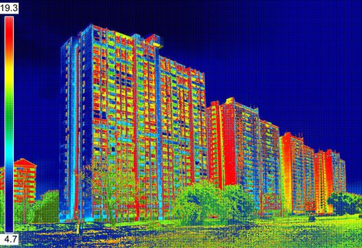
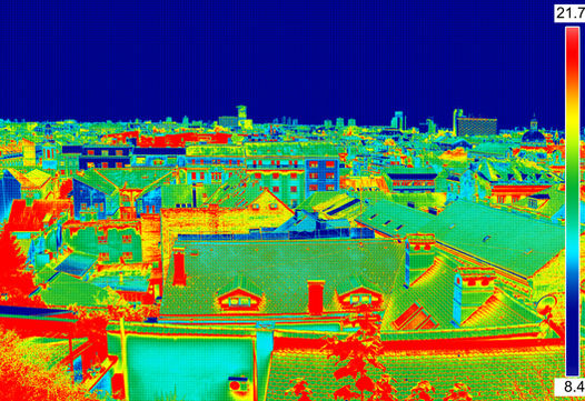
Drone thermal imaging is a revolutionary technology that captures and records temperature data from an aerial perspective. But did you know that we can take this technology even further by turning the thermal images into a thermal orthomosaic and a thermal 3D model?
Thermal orthomosaics are created by stitching together multiple thermal images to create a detailed aerial view of the temperature patterns in an area over a period of time. This information can be incredibly useful for identifying areas of energy loss in buildings, detecting hotspots in electrical systems, or even locating wildlife at night.
Thermal 3D models, on the other hand, take the thermal imaging data to the next level by creating a three-dimensional model of the area. This provides an even more detailed view of the temperature patterns and can help you identify issues more precisely. With a thermal 3D model, you can examine the temperature patterns from any angle, providing a more comprehensive view of the data.
ROOFING EXAMPLES
Welcome to Teslas Drones roofing examples, where we showcase the power of our drone technology for roof inspections.
Our team of experienced and licensed drone pilots are dedicated to providing the highest quality drone services possible to clients in the roofing industry.
With our cutting-edge drones, we can perform inspections in hard-to-reach areas, providing high-quality visuals and data that are essential for identifying potential problems and ensuring the safety and longevity of your roof.
From detecting leaks to assessing storm damage, our drone inspections can help you make informed decisions about your roofing needs. Browse our examples below to see how we've helped other clients in the roofing industry.
ROOF REPORT
Using orthomosaic maps, our roofing solutions use computer vision and machine learning algorithms to generate highly accurate roof measurements created from our drone images.
This makes it possible to measure square footage, roof features, pitch, surface area, and slope consistently across every site. This information is incredibly useful for inspecting roofs and identifying any issues that need to be addressed.
Our drones are quick and efficient when we arrive on the scene. It usually takes us 20-40 minutes to take the images needed to create a roof report for a medium-sized house. After that, it takes only a few hours to create a detailed roof report like the example shown above.

ROOF INSPECTION
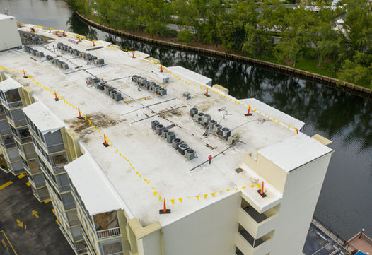
Our drone roof inspections are the perfect solution to avoid the dangerous and risky task of inspecting your roof manually. With Teslas Drones, our state-of-the-art technology and expert pilots can get the job done safely, quickly, and accurately. Our drones can capture high-resolution images of your roof and identify any damage or areas of concern without ever setting foot on your roof. This means that you can avoid the risks associated with manual inspections and save time and money in the process. So why not let Teslas Drones provide you with a safe and efficient solution for your roof inspection needs?
THERMAL ROOF REPORT
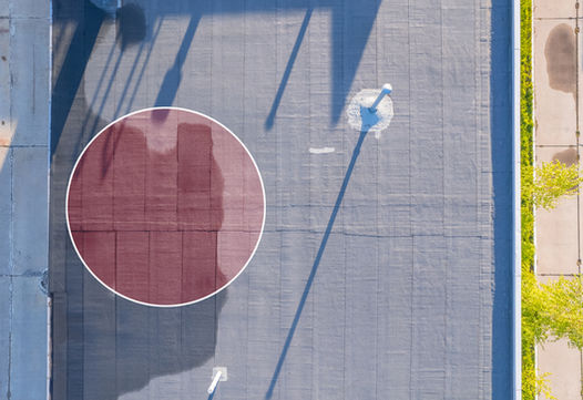
Drone thermal imaging is a revolutionary technology that utilizes specialized cameras to capture and record temperature data from an aerial perspective. With this technology, you can identify heat loss, water leakage, and insulation issues in your home or commercial building. Information like this can provide you and your team with actionable insights to make informed decisions about energy efficiency and repairs.
Drone thermal imaging is an incredibly efficient and cost-effective way to inspect large areas and identify potential issues quickly. It is especially useful for the construction and roofing industries, as well as for home and building inspections.
AGRICULTURE EXAMPLES
Welcome to Teslas Drones agriculture examples, where we showcase the ways our drone technology can revolutionize modern farming.
At Teslas Drones, we understand that farming is both a challenging and rewarding endeavor, and we're committed to helping farmers achieve their goals by providing accurate, real-time data on crop health, irrigation, fertilization, and more.
Our agricultural drone inspections can help you make informed decisions about your crops, leading to increased yield and profit. With our cutting-edge technology, we can create 3D models and orthomosaic maps of your land, giving you detailed insights into your fields like never before.
Join the ranks of innovative farmers who are using drone technology to take their farming operations to the next level.
GROUND MAPPING
Agriculture is one of the oldest industries in the world, but it has seen a lot of advancements over the years. One of the latest technologies that farmers can take advantage of is the orthomosaic map.
An orthomosaic map is a cutting-edge technology that combines satellites, artificial intelligence, and high tech computers to produce an accurate aerial image of a property like you see of the left. This is what we call an orthomosaic map.
This map then allows you to take measurements such as height, depth, length, area, and volume with an accuracy of 99.4%! This may not seem like a lot but our drone technitions can pull SO much information from this map! For example, orthomosaic maps can help farmers to monitor their crops and soil health, track crop growth, detect areas of disease or poor growth, and analyze their irrigation systems to improve efficiency and ultimately save water and reduce costs.
AGRICULTURAL PLANT HEALTH ANALYSIS
If you want to ensure that your crops are healthy and producing high yields, our plant health analysis service is the perfect solution for you. Our service can accurately identify the exact percentage, size, and location of stress zones in your crops and provide a comprehensive assessment of your plant health. This means that you'll know precisely which areas of your field are experiencing problems, whether it's due to diseases, drought, or other yield-limiting factors.
By ordering our plant health analysis service, you'll receive a detailed report that includes a map of your field, highlighting both healthy and problem-causing areas. Our service can be performed throughout the entire growing season, but it's particularly useful when preparing for mid-season and late-season tasks, as it serves as a regular plant and pre-harvest monitoring tool.
Our plant health analysis has been proven to be effective with forestry, field, and plantation crops, as well as vegetables. With our service, you can take timely action to improve your yield, increasing your revenue and ensuring your farm's success. So don't let your crop yield suffer any longer - invest in our plant health analysis service and get the insights you need to optimize your crop management.


STRESS DETECTION
Looking for an accurate and precise way to detect stresses such as weeds, rust in your field, or pest infestations? Our stress detection service can help. By using our advanced technology, you can easily identify hotspots and take immediate corrective measures to optimize your control techniques.
Our service can also help you conserve herbicide usage, ultimately saving you time and money. By reducing the over-application of herbicide, we can minimize the risk of herbicide runoff, making it an eco-friendly option for your farm.
Investing in our stress detection analysis service can lead to improved efficiency, cost savings, and environmental sustainability on your farm. Don't wait, try our service today and see the benefits firsthand!
STAND COUNTS
Our stand count service eliminates the need for manual, time-consuming, and inaccurate stand counts by creating a comprehensive map of the crops using artificial intelligence and skilled pilots. Conducting traditional stand counts is not only laborious and inefficient, but it also leaves room for significant errors, making it a considerable challenge.
With a drone created stand count, agricultural professionals can gain valuable insights into the crops, such as whether the operator is driving too fast or too slow, whether soil or planter conditions will impact emergence, and whether insects, pests, or other environmental factors have affected certain areas.
In short, they provide real-time, accurate, and reliable information on crop status and has numerous advantages for agricultural professionals. It saves time and effort, reduces errors, and allows for better decision-making, resulting in improved crop yields and higher profits.


INSPECTION EXAMPLES
Welcome to Teslas Drones inspection examples, where you can see firsthand the incredible results our drone inspections can provide.
Our team of experienced drone pilots and industry professionals are passionate about using the latest drone technology to make inspections faster, easier, and safer for a variety of industries.
With our cutting-edge drone technology and expert knowledge, we provide our clients with high-quality visual and data inspections that are essential to their business operations. Browse through our examples and see for yourself how our drone inspections can revolutionize your industry.
PHOTO & VIDEO INSPECTIONS
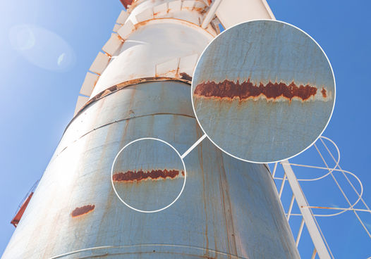
Drone inspections have benefited inspections in a multitude of ways, including identifying potential structural issues such as cracks or corrosion. Using drones to take high-quality photographs of structures, inspectors can zoom in and examine the images to detect even the smallest of flaws.
The benefit of using drones for this type of inspection is that it is a non-invasive method, which means that the structure does not have to be physically accessed by an inspector, reducing risk and costs.
Additionally, drones can capture images from unique angles that are not accessible to human inspectors, providing a more thorough examination of the structure. With these benefits, drone inspections have become an increasingly popular choice for inspections.
THERMAL INSPECTIONS
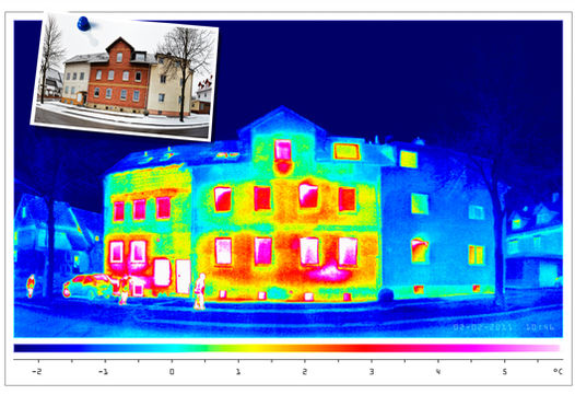
Drone thermal imaging is a revolutionary technology that utilizes specialized cameras to capture and record temperature data from an aerial perspective. With this technology, you can identify heat loss, water leakage, and insulation issues in your home or commercial building. Information like this can provide you and your team with actionable insights to make informed decisions about energy efficiency and repairs.
Drone thermal imaging is an incredibly efficient and cost-effective way to inspect large areas and identify potential issues quickly. It is especially useful for the construction and roofing industries, as well as for home and building inspections.


