Mapping the World: Drones and the Creation of Digital Twins
- Archer Tesla

- Jan 21
- 3 min read

Imagine walking through a perfect virtual version of your town, a place where every tree, building, and street corner looks exactly like the real thing. That’s the power of a digital twin: a detailed, living, 3D version of a real-world place that helps people plan, study, and protect the environments we care about most.
And believe it or not, drones are at the heart of this technology.
At Teslas Drones, we use drones every day to turn photos from the sky into rich, accurate 3D maps, and sometimes, full digital twins. Here’s what that means, how it works, and why it matters more than ever.
What Is a Digital Twin?
A digital twin is a digital copy of something real, like a building, a construction site, a forest, or even an entire city. But unlike a simple 3D model, a digital twin can grow, change, and update as the real world changes.
For example, city planners in Singapore use a “Virtual Singapore” model to test new building layouts, track traffic, and plan for floods before they happen. It’s like having a sandbox version of the real world, where data drives smarter decisions.
In short: a digital twin helps you see the big picture, make plans with precision, and respond faster to change.
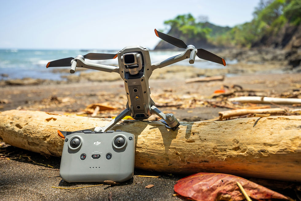
Why Drones Are Perfect for the Job
Drones are the ultimate mapmakers. Here’s why they’re so good at building digital twins:
They see from above. Drones can reach places people can’t, rooftops, cliffs, or dense forests, capturing detailed views from every angle.
They capture incredible detail. Using advanced cameras and sensors like LiDAR (which measures distance with lasers), drones record real-world shapes with centimeter-level precision.
They’re fast and flexible. Drones can cover large areas quickly, fly set routes automatically, and repeat flights whenever you need an update.
Put it all together, and drones give us the perfect data to build a digital twin that’s both accurate and up to date.
How It All Comes Together
Here’s a simple look at how a digital twin is made:
Plan the flight. We map out the area, setting altitude and camera angles to make sure nothing gets missed.
Fly and capture. The drone takes hundreds (sometimes thousands) of photos, overlapping them so software can “stitch” them together later.
Process the images. Specialized programs like Pix4D or DJI Terra combine all those photos into a single, detailed 3D model.
Add accuracy. We use GPS points and other data to make sure the digital twin matches real-world coordinates exactly.
Update over time. As the real environment changes, we can re-fly the same area to show progress, damage, or growth over time.
The result? A living, evolving map of the world, crafted through the power of drone technology.

Where Digital Twins Are Making an Impact
Digital twins are already transforming how industries and communities work. Here are a few examples that inspire us:
Historic preservation. A digital twin of the USS Alabama battleship helped conservators plan repairs without risking the real thing.
Here's a link to explore more about this: https://www.microdrones.com/en/content/view-a-drone-lidar-digital-twin-of-the-uss-alabama-battleship-memorial-park/
Construction and engineering. Builders now use drone-generated twins to track progress, compare “as-built” vs. “planned” designs, and catch problems early.
Urban and environmental planning. Cities and environmental groups use drone mapping to monitor erosion, forest growth, and coastline changes, helping protect local ecosystems.
They’re not just beautiful models, they’re powerful tools that help people make smarter, safer choices.
What Makes a Great Digital Twin
Creating a reliable digital twin takes more than just good photos, it’s about precision. Here’s what we focus on:
Flying when lighting is consistent and calm.
Capturing images from multiple angles (roofs, sides, overhangs).
Using GPS and ground markers to lock in exact coordinates.
Keeping data organized so updates can be added easily.
When done right, the final product isn’t just a model, it’s a true-to-life virtual tool ready to be used for years.
Why It Matters
Digital twins give people the power to understand and improve the spaces they care about. With them, you can:
Walk through a site virtually and plan ahead.
Monitor long-term changes like erosion, forest growth, or construction progress.
Share visual updates with teams, clients, or community members, all seeing the same accurate data.
For communities, landowners, and businesses alike, digital twins are changing how we see and care for our world.

The Future of Mapping
We’re moving toward a future where digital twins will be everywhere, from neighborhoods to natural landscapes. Imagine being able to check the health of a forest, track a coastline, or view your city’s growth in real time.
That’s the direction we’re headed. And drones are leading the way.

Comments