Guarding Nature from Above: Drones Tackling Erosion & River Damage Where Satellites Can’t Reach
- Archer Tesla

- May 20
- 3 min read
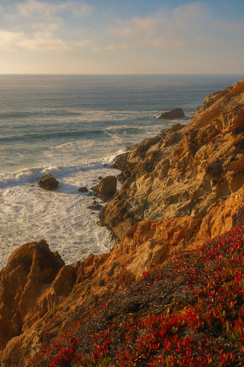
We often imagine drones soaring through the sky to capture cinematic views, but some of their most important missions happen much closer to the ground. Over rivers, banks, and fragile landscapes, drones are stepping in where satellites struggle, helping scientists and communities monitor, measure, and respond to erosion and river damage before disaster strikes.
And in 2025, the call for this kind of aerial insight is louder than ever. Let’s explore how drones are becoming guardians of waterways and what makes them so effective in protecting our environment.
Why Satellites Alone Can’t Do the Job
Satellites are amazing for global perspectives, but when it comes to erosion and river health, they’re not always enough.
Timing gaps. Many satellites only pass over an area every few days or weeks, making it easy to miss flash erosion or sudden riverbank collapses.
Clarity issues. Cloud cover, haze, or thick tree canopies can block the view. And even when skies are clear, satellites often lack the fine detail needed to spot subtle soil shifts or slope changes.
This is where drones shine. Flying low and flexible, drones deliver high-resolution, repeatable data, letting us catch problems early and act quickly.
Tools of the Trade: How Drones Monitor Erosion & River Damage
Thanks to cutting-edge research and fieldwork, drones are now equipped to tackle erosion and waterway monitoring with incredible precision.
High-Resolution Mapping
By flying grid missions over vulnerable areas, drones generate orthomosaic maps, digital elevation models (DEMs), and even 3D point clouds. When repeated over time, these maps reveal how soil moves, river channels shift, and banks erode, down to the centimeter. You can read more HERE!
Real-Time Flow Tracking
In 2025, researchers introduced RivAIr, a UAV-based sensor system that estimates river surface velocity using optical flow and computer vision, offering live insights into how fast water is cutting into banks. You can read about RivAIr HERE!
LiDAR & Laser Scanning
Drones equipped with LiDAR are transforming erosion monitoring. The Skidaway Institute of Oceanography recently used LiDAR drones on Tybee Island, Georgia, to track beach and dune retreat with unmatched accuracy.
Early Warnings on the Ground
In Canada, Kawartha Conservation used drones with RTK (Real-Time Kinematic) positioning in 2025 to spot drainage patterns and erosion-prone zones before sediment spilled into nearby waterways.
Smarter, Faster Detection
Some drones now use edge computing to analyze data onboard, spotting failing slopes or shifting sediment in real time without waiting for data uploads. This is pushing the frontier of autonomous environmental monitoring.

Stories from the Field: Drones in Action
Ontario, Canada (2025). At a site near Sucker Creek, drones mapped soil layers and drainage routes, helping conservationists create erosion-prevention plans before sediment reached the waterway. Check it out HERE!
Tybee Island, Georgia (2025). Drones flew repeat surveys over dunes and beaches, revealing exactly where sand loss was worst. City planners used this data to guide targeted beach renourishment projects. Check it out HERE!
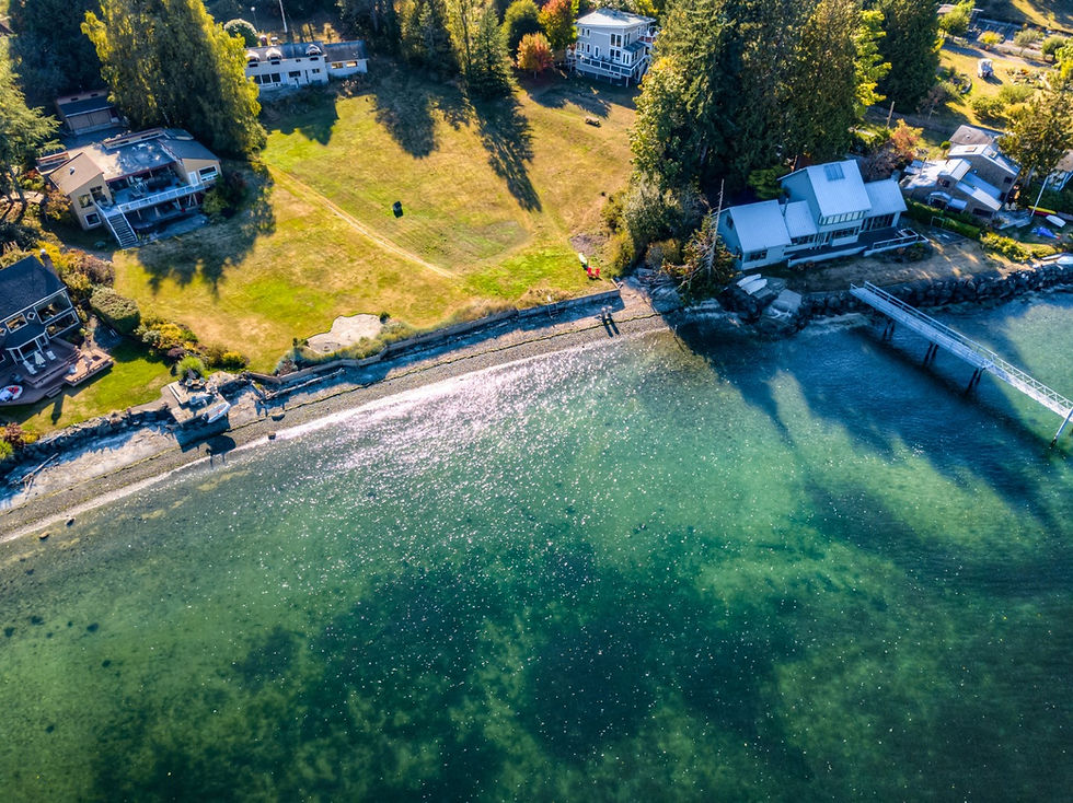
Washington State (2025). Along the Snohomish River, local conservation groups have begun testing drone surveys to track seasonal flooding and bank erosion near salmon habitat. With drone-based orthomosaics, they can compare bank lines year after year, helping protect critical spawning grounds while supporting nearby communities. Check it out HERE!
These aren’t just snapshots, they’re lifelines for landscapes balancing human needs with natural resilience.

The Hurdles Ahead
As powerful as drones are, monitoring erosion from above isn’t without challenges:
Wind, glare, or spray can affect flight stability and accuracy.
Long missions require batteries and endurance tech that are still catching up.
Data sets are massive, processing them means serious computing power.
Permits are needed for waterways, wildlife zones, or private land.
Integrating drone data with ground sensors and satellite data takes coordination.
Still, the advantages, early detection, smarter interventions, and more resilient ecosystems, make drones too valuable to ignore.
Why It Matters Now More Than Ever
Climate change is speeding up erosion everywhere. Stronger storms, heavier rains, and shifting rivers mean banks that once felt stable are suddenly at risk. In the Pacific Northwest, that could mean swollen rivers, undermined infrastructure, or damage to salmon habitats.
By flying where satellites can’t, drones give us:
A head start on identifying erosion hot spots
The ability to prioritize repairs before they get costly
Clear records of how landscapes evolve year to year
Powerful advocacy tools for better land and water management
Simply put: drones aren’t just data collectors. They’re guardians of our waterways.
Final Thoughts About Nature’s Watchdogs in the Sky
Satellites give us the big picture. But for rivers, banks, and fragile landscapes, we need the fine print, and drones are delivering it.
This is where technology meets purpose, using innovation not just to capture beauty, but to preserve the landscapes and communities that make our world worth seeing.


Comments